(if you know origin of this please let me know See below for origin of video, thank you Wade!)
The location on video: N42.253245,W89.028622
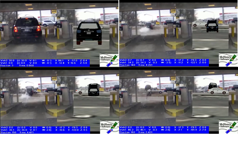
For quick comparison/demonstration put location in msmac3D, pulled in 3D terrain, put in cars (i guessed at) and did accelerations of vehicle away from the teller location and vehicle across the roadway in distance until i generally matched the trajectory.
I took 30 min to create this 30 second demonstration of some of the capabilities of msmac3D.
NOTE IMPORTANT ITEMS NEEDED FOR DETAILED ANALYSIS:
- Did not model the left side tires interaction with the teller island curb (since no information on size/etc)
- Did not model the vehicle tires striking/interacting with the roof of the crossing vehicle.
- Did not know actual make/models/etc of vehicles or actual distance from the stop location to the bottom of the small hill that launched it.
- Did not know the details of the hill only the general change in the elevation from parking lot to roadway and distance from roof of teller location to bottom of the hill from satellite photo (Google Maps provides elevations every 5-10 feet so not enough detail for the small hill/ramp and curb)